Log in
All resources
Create a design
11,660 Free Images of Old Map
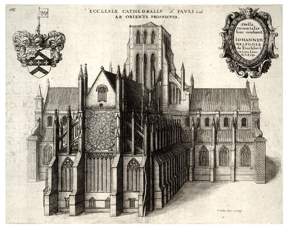
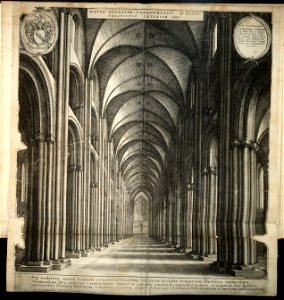
architectural prints by wenzel hollar
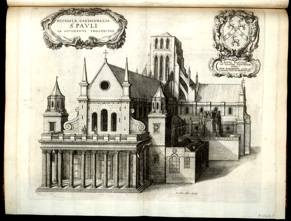
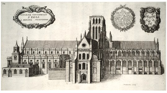
old st paul's cathedral
university of toronto wenceslas hollar digital collection
hollar maps and plans of london
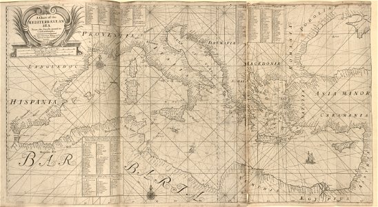
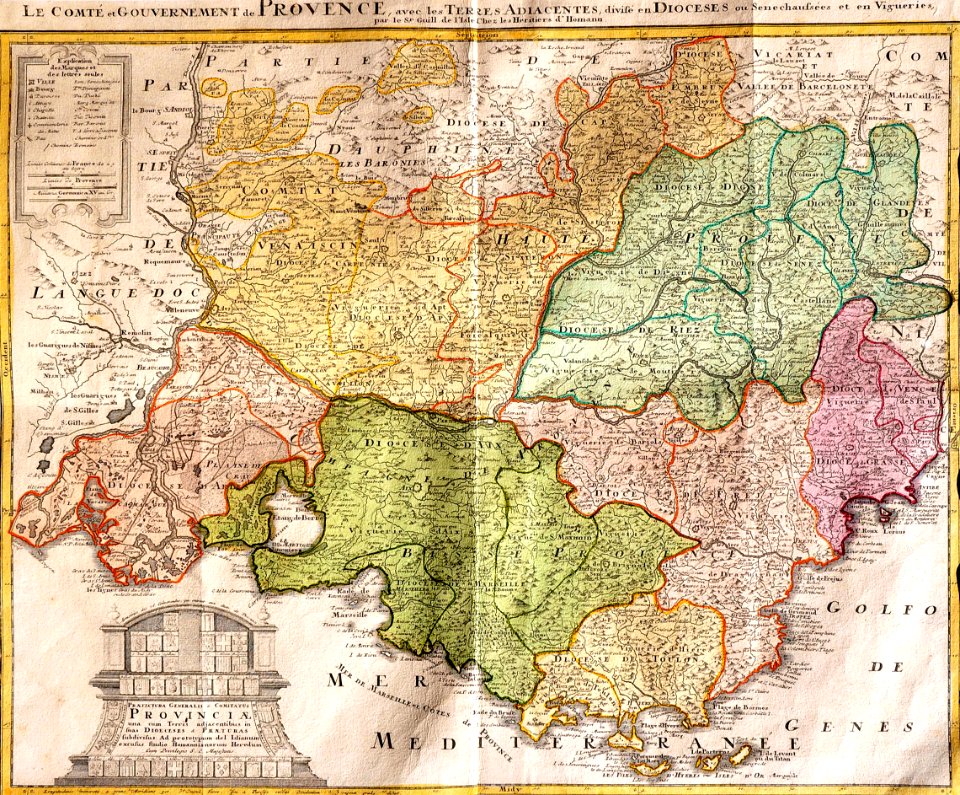
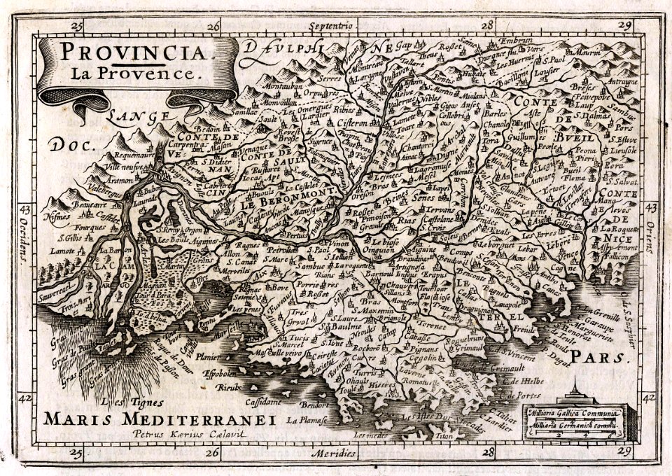
old maps of europe
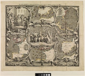
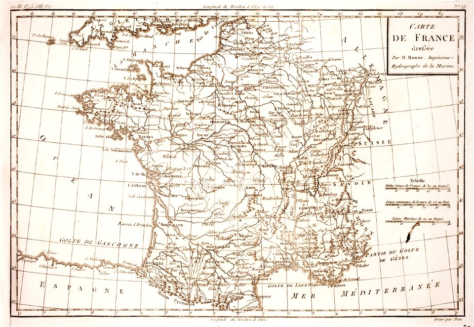
18th-century engravings
maps made in the 18th century
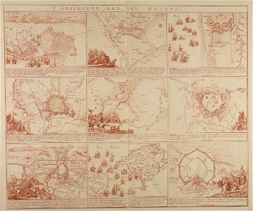
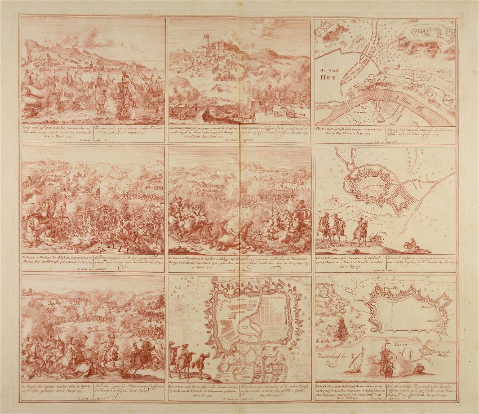
war of the spanish succession
atlantis magni tomus primus (biblioteca comunale di trento)
pieter schenk (i)
travel
maps
river
roads
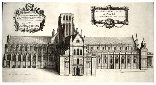
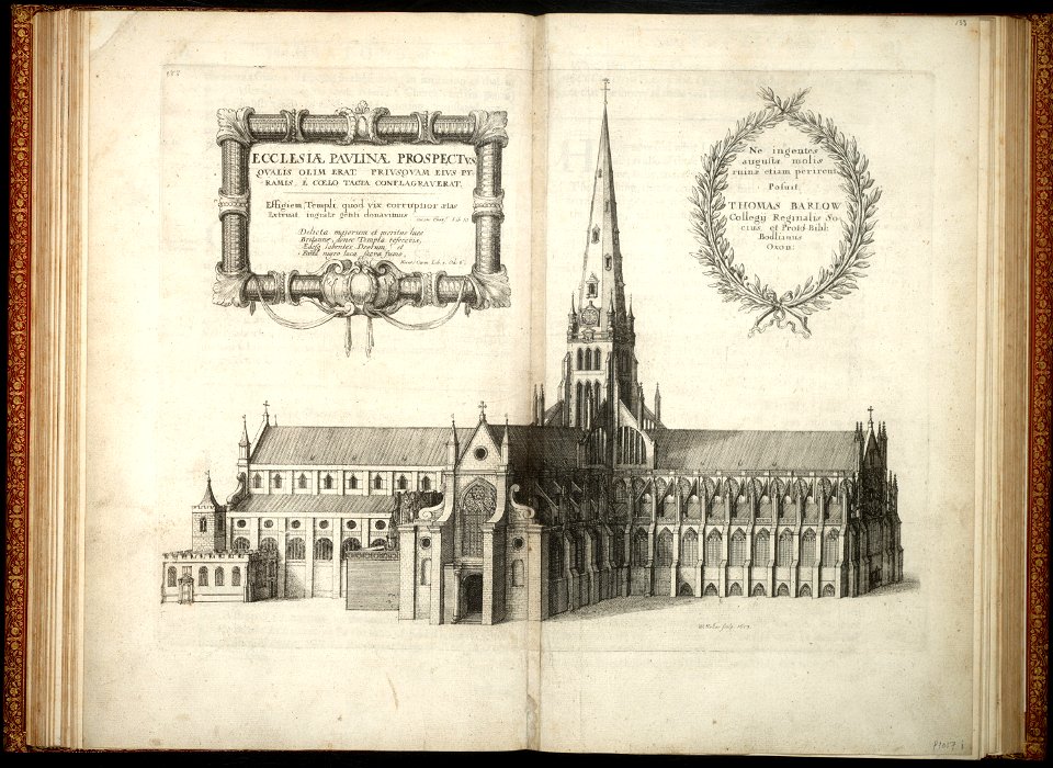
architectural prints by wenzel hollar
old st paul's cathedral
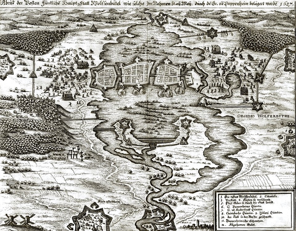
gottfried heinrich graf zu pappenheim
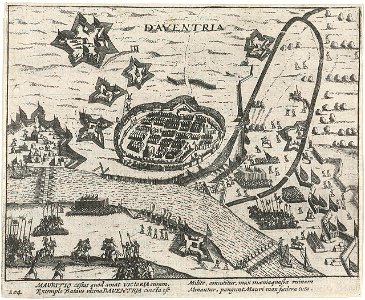
battles of the thirty years' war
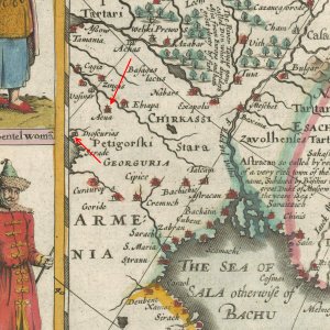
old maps of armenia
card
engravings by matthäus merian
1672 engravings
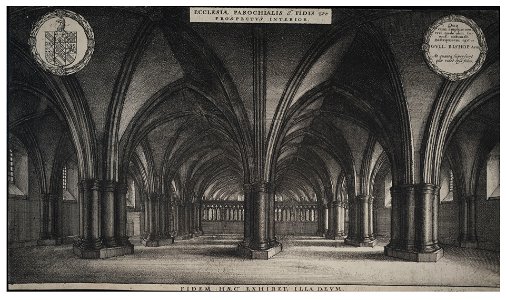
architectural prints by wenzel hollar
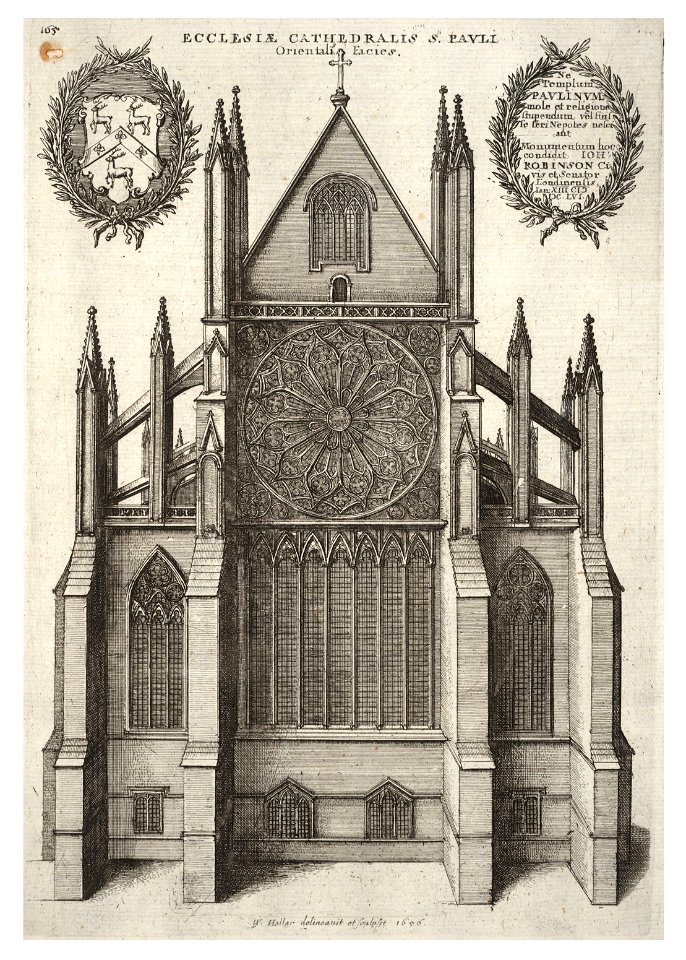
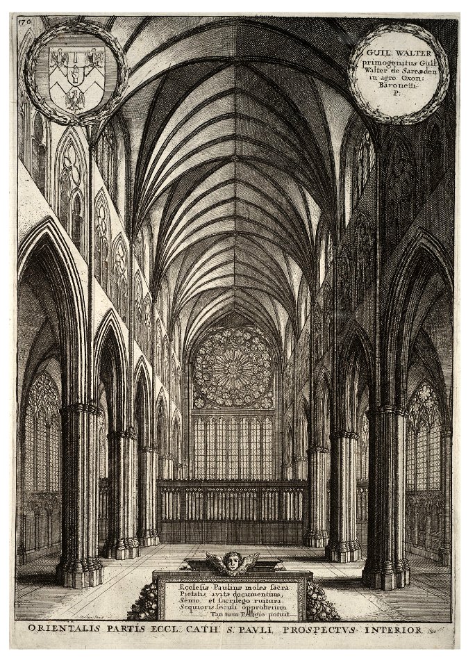
old st paul's cathedral
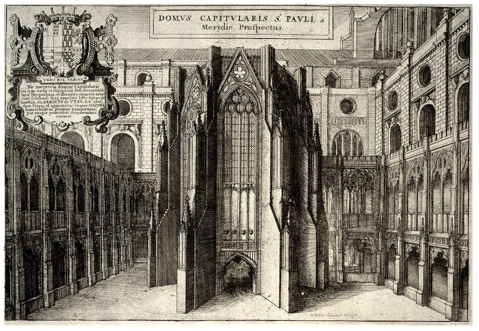
architectural prints by wenzel hollar
old st paul's cathedral
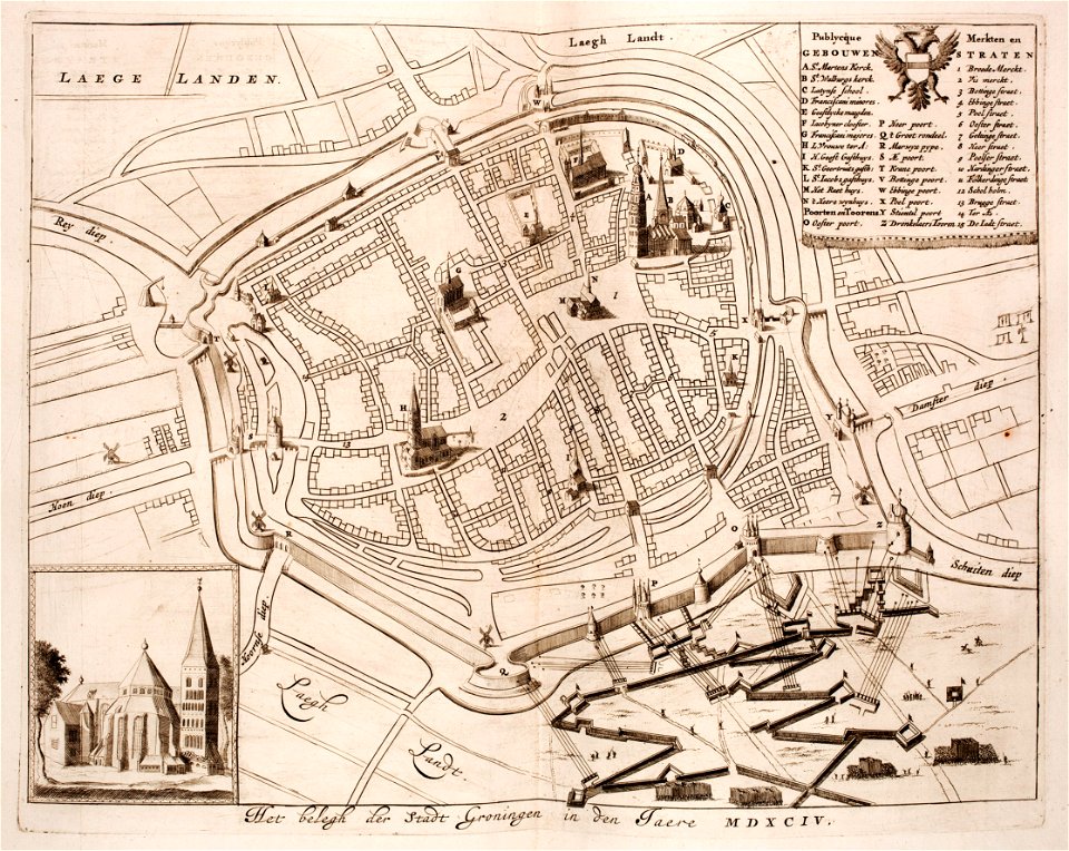
old maps of groningen (city)
siege of groningen (1594)
media contributed by agad presented in former polska.pl portal
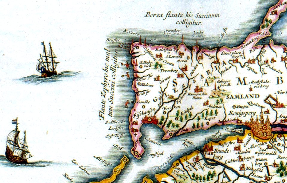
old maps of pomerania
1726
asie
historical images of pont neuf
lithographs of paris
self-published work
1715 maps
self-published work
1628 maps
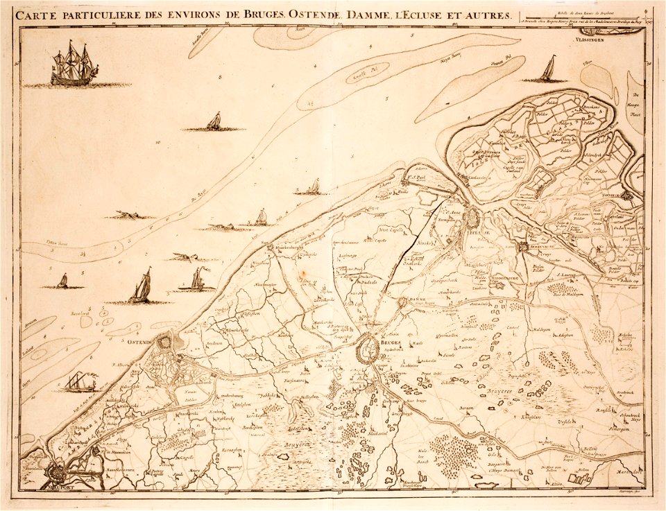
prints from fricx table des cartes des pays-bas at the peace palace library
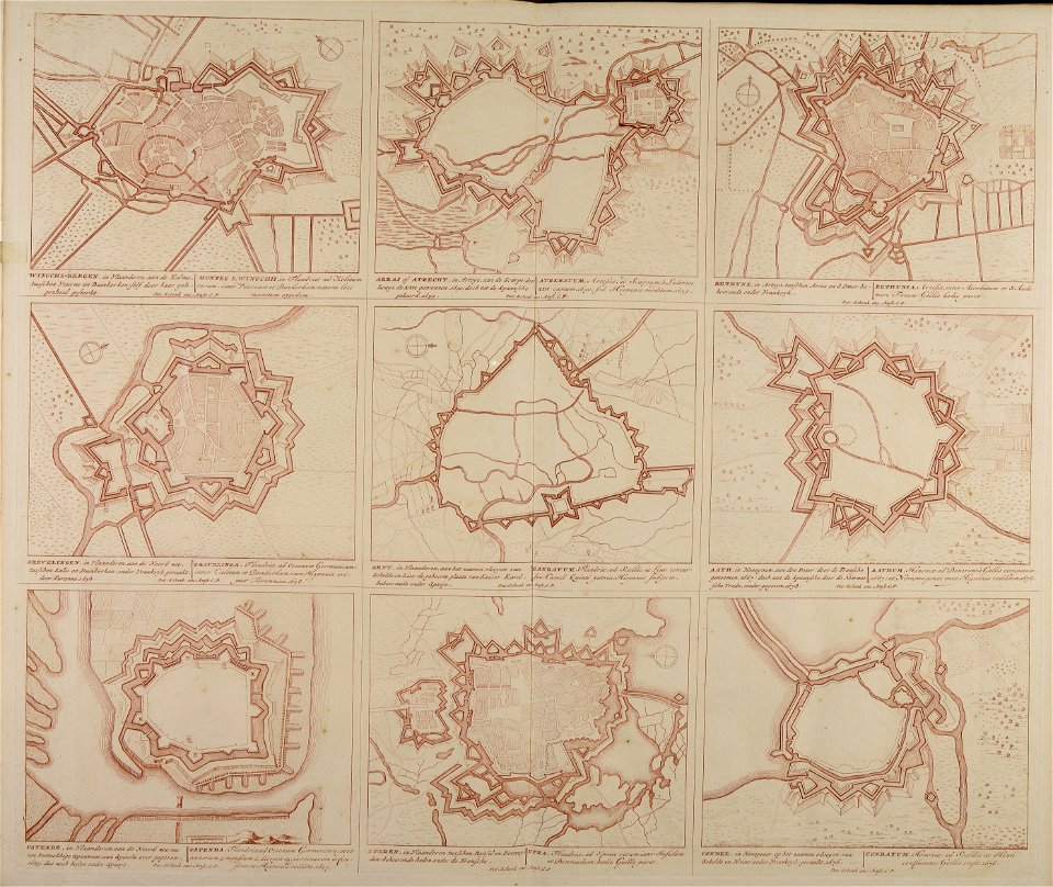
old maps of flanders
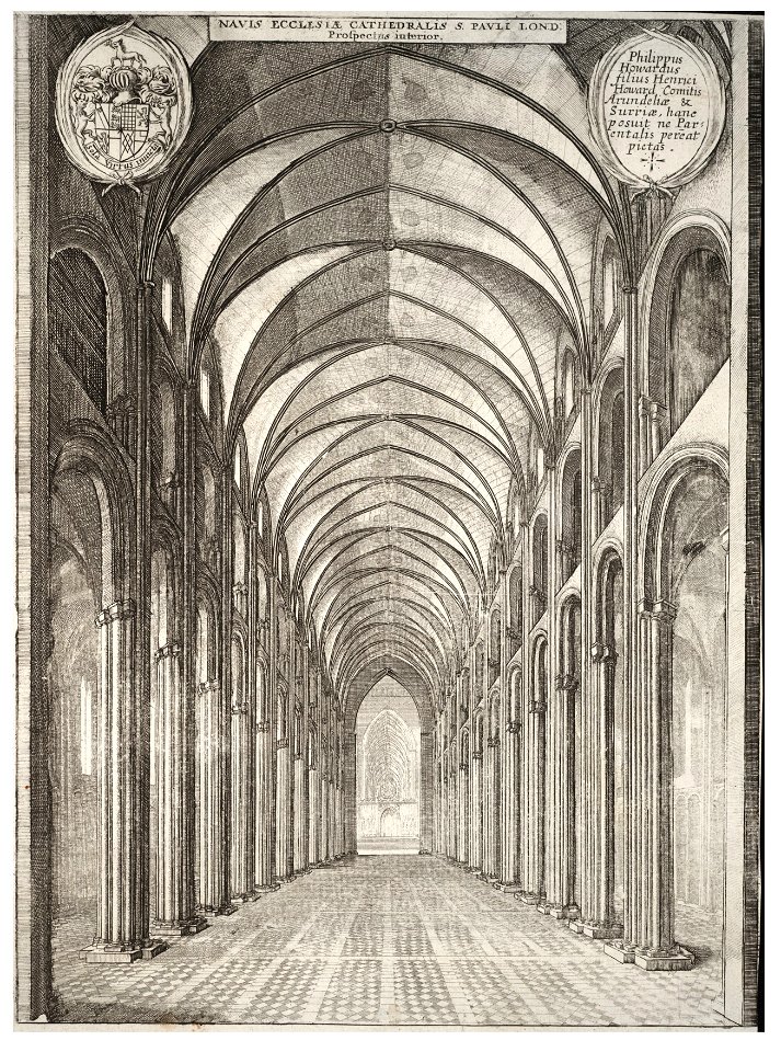
architectural prints by wenzel hollar
old st paul's cathedral
architectural prints by wenzel hollar
old st paul's cathedral
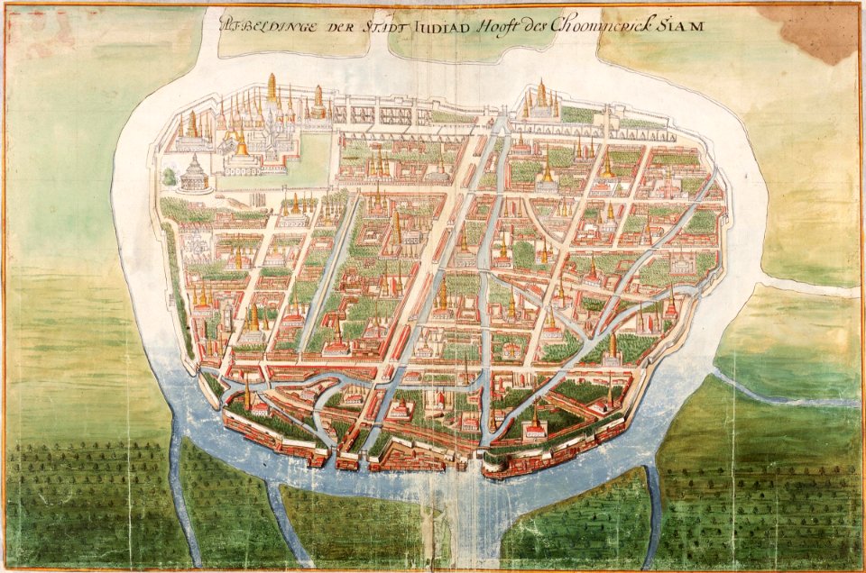
ayutthaya kingdom
1665
17th-century maps of pomerania
old maps of rügen
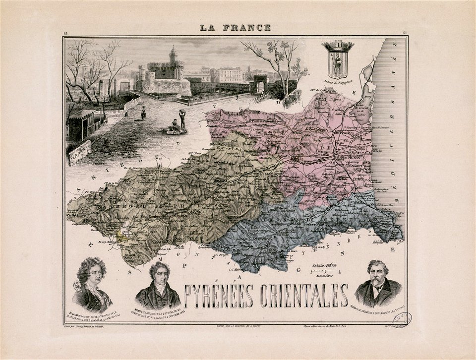
alexandre-joseph oliva
hyacinthe rigaud
maps in the library of congress
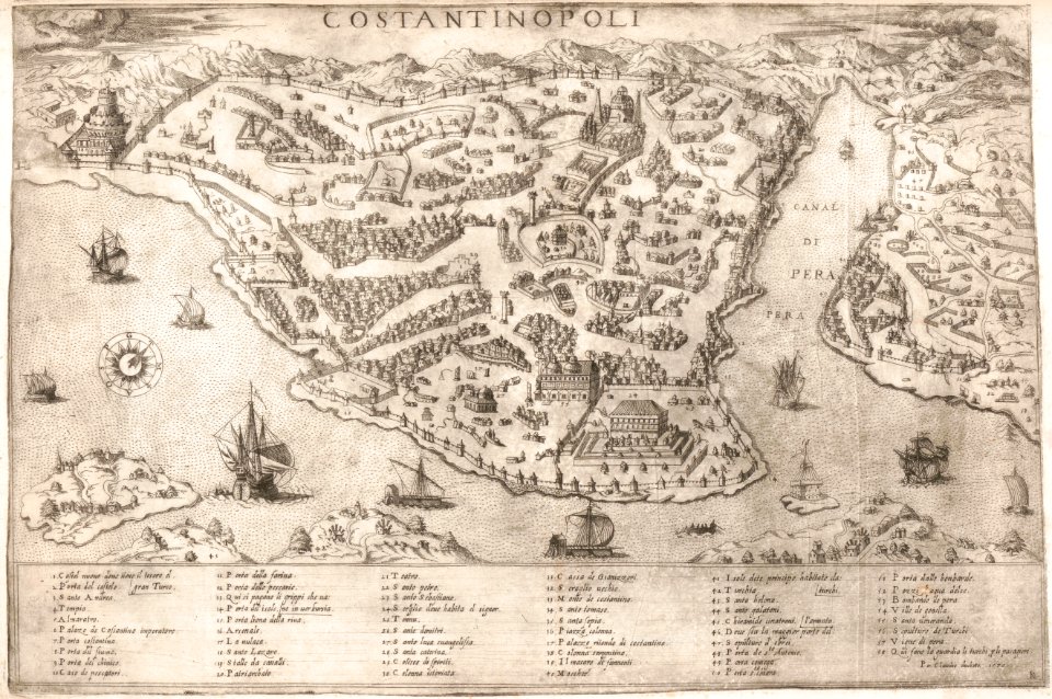
old maps of istanbul
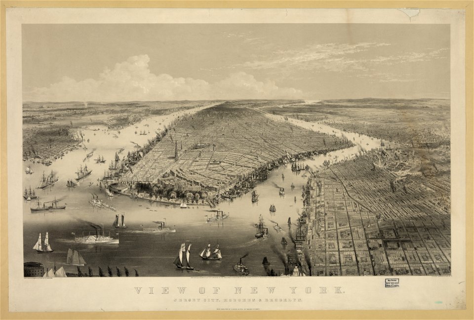
chromolithograph
new york city
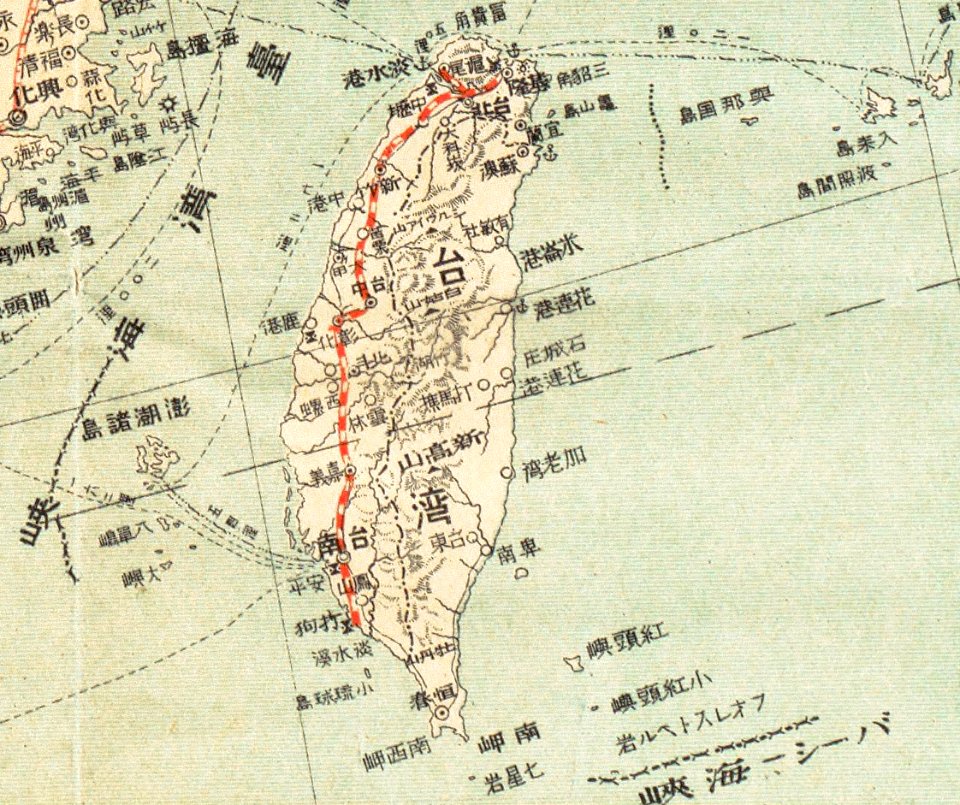
old maps of taiwan
chinese writing
architectural prints by wenzel hollar
old st paul's cathedral
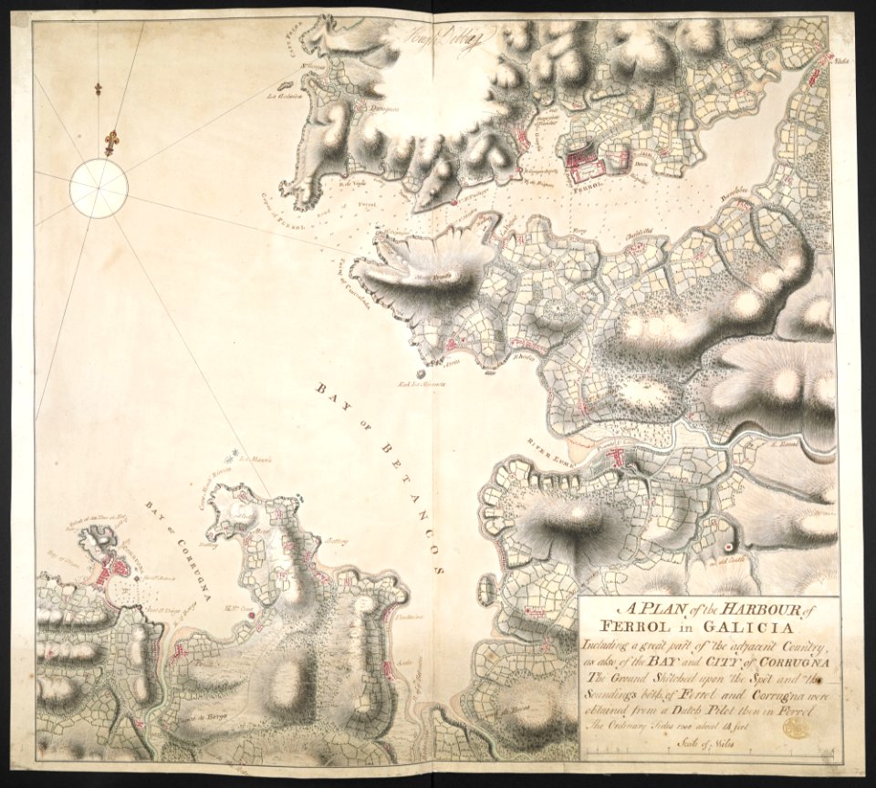
old maps of the province of a coruña
1767 in galicia (spain)
atlas van der hagen
copper engraving
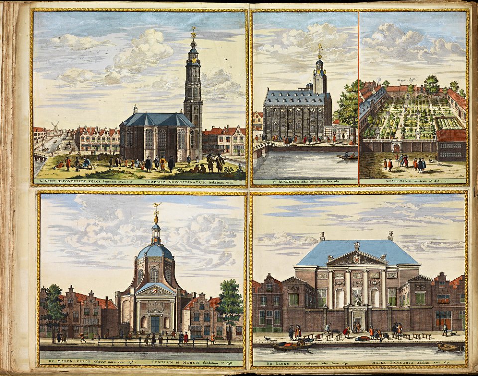
oude kerk amsterdam in art
frederick de wit
floor plans of paris
engravings of paris
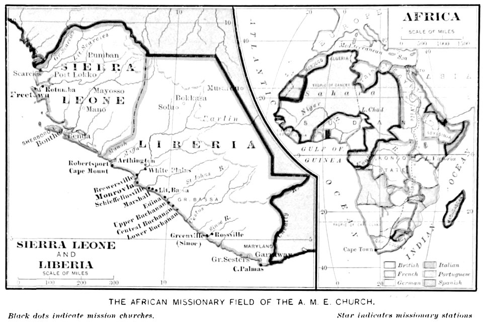
old maps of sierra leone
old maps of liberia
bird
maps
bird
maps
background
maps
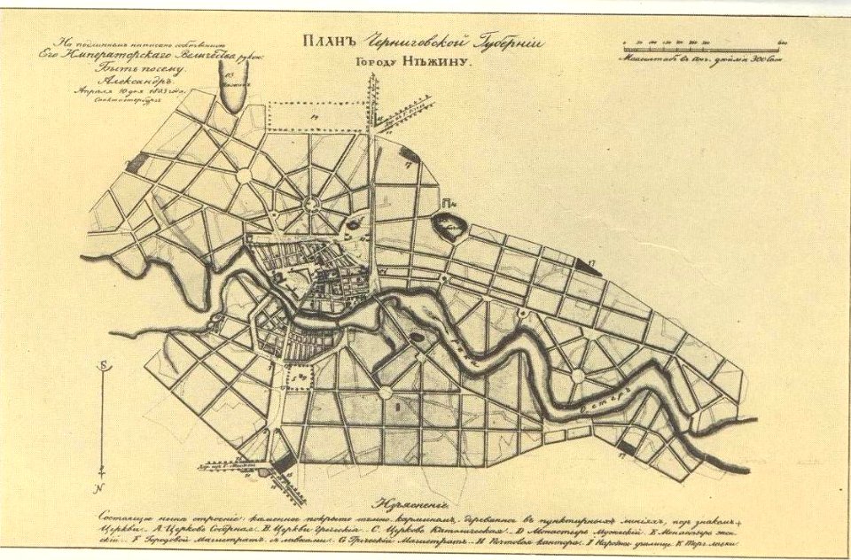
old maps of nizhyn
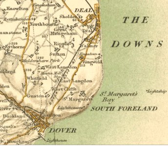
sutton
kent
maps of civil parishes of västergötland
old maps of västergötland
old maps of europe
printing
architectural prints by wenzel hollar
old st paul's cathedral
architectural prints by wenzel hollar
old st paul's cathedral
architectural prints by wenzel hollar
old st paul's cathedral
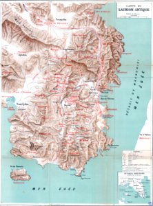
mining in greece
maps of laurium
maps by philippe vandermaelen
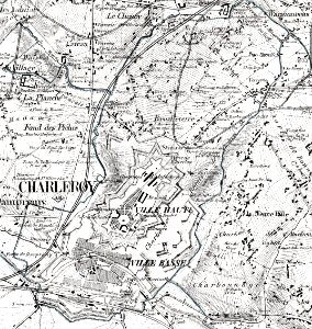
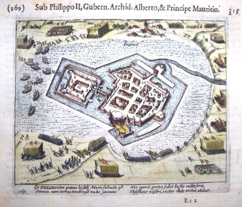
old maps of charleroi
topographical paintings in the centraal museum
16th-century paintings in the centraal museum
mother
maps
maps made in the 18th century
18th-century engravings
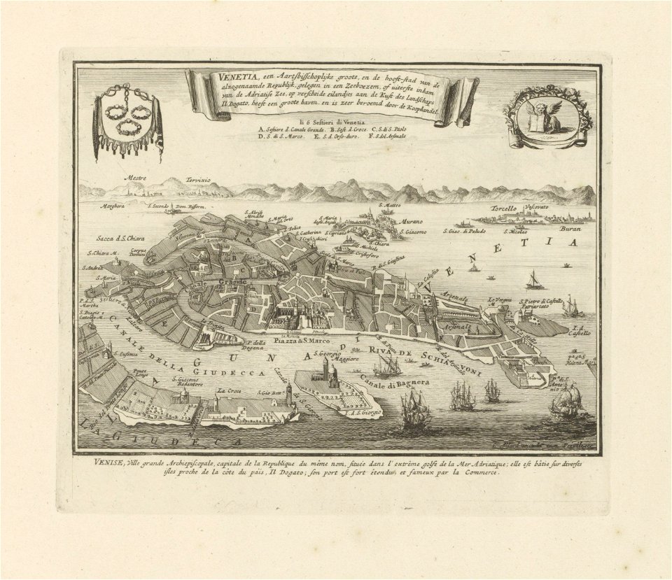
old maps of venice
carolus allard
maps in skokloster castle
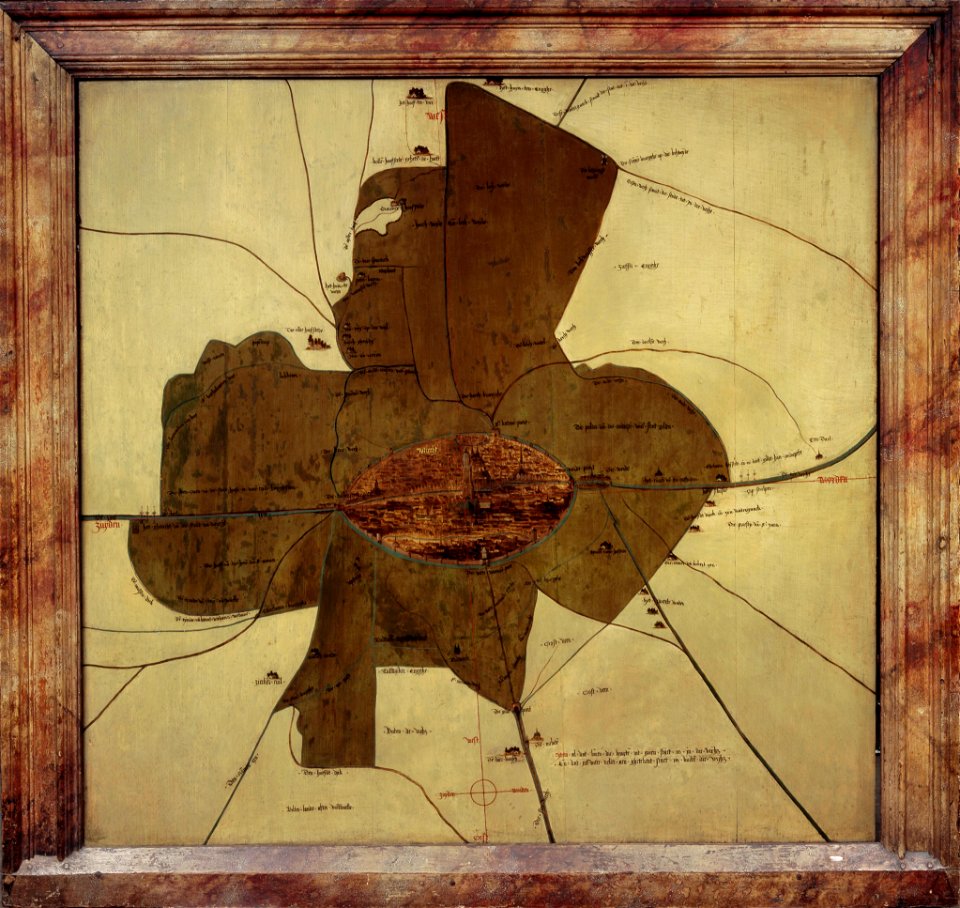
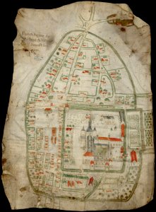
old map
architectural prints by wenzel hollar
old st paul's cathedral
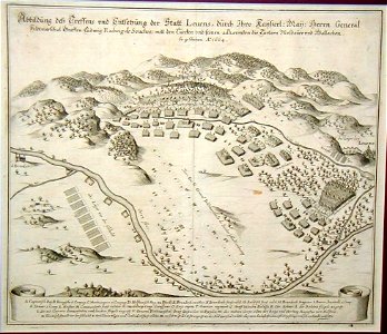
battles of the thirty years' war
cologne
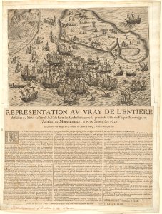
historical images of île de ré
siege of la rochelle
françois collignon
1646
dutch 17th-century prints in the rijksmuseum amsterdam
ijssel
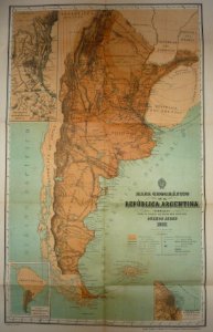
19th-century maps of argentina
old maps of chile
historical images of the pont saint-michel
lithographs of paris
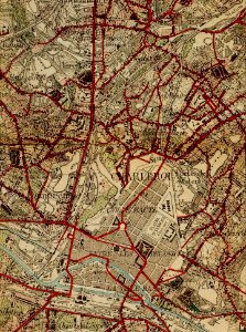
old maps of north rhine-westphalia
maps with cartouches
atlas van der hagen (volume 4)
maps with cartouches
maps made in the 18th century
18th-century engravings
maps made in the 18th century
18th-century engravings
maps made in the 18th century
18th-century engravings
bird
maps
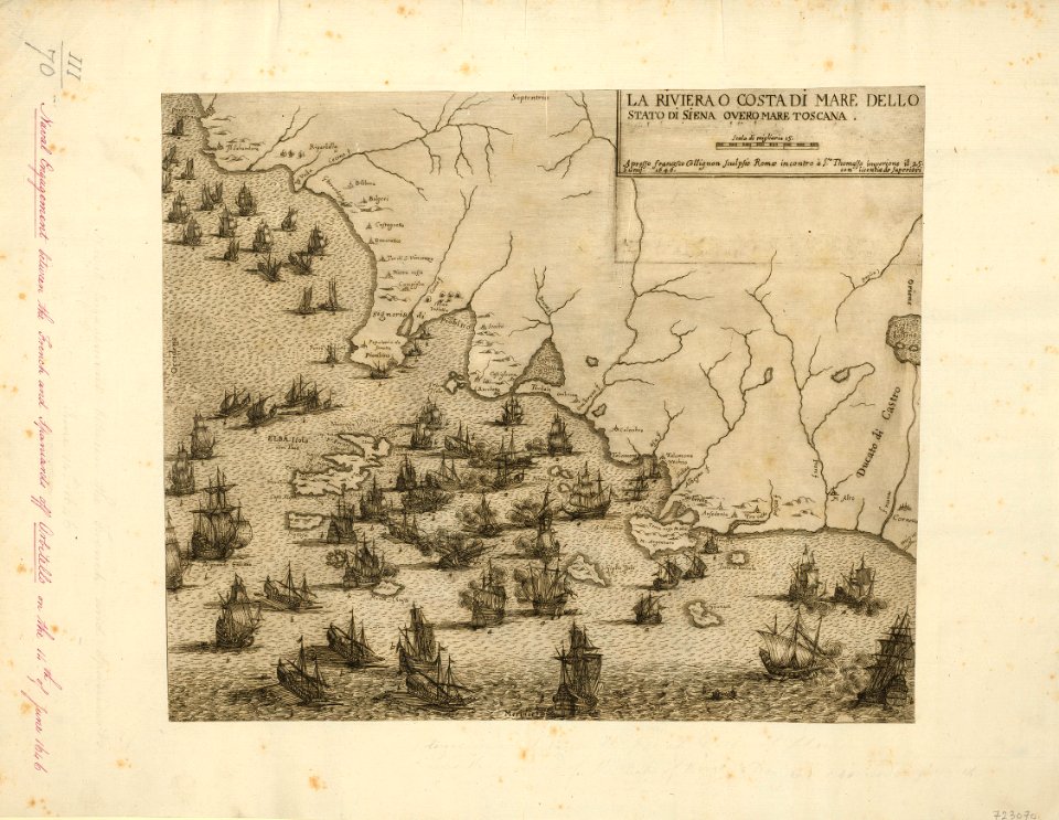
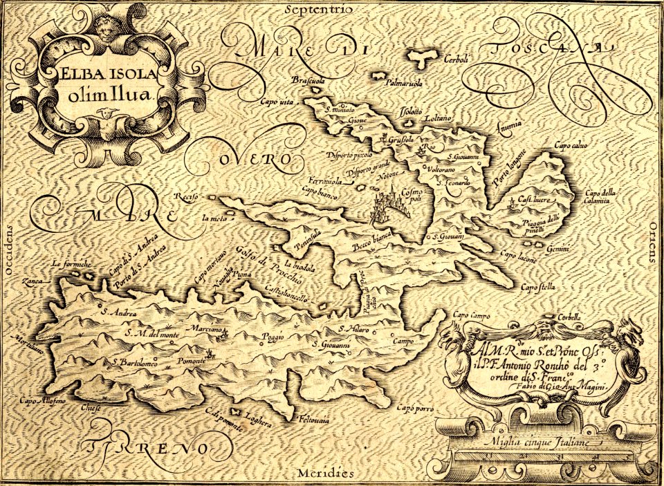
maps by giovanni antonio magini
old maps of elba
maps made in the 18th century
18th-century engravings
maps made in the 18th century
18th-century engravings
maps made in the 18th century
18th-century engravings
maps made in the 18th century
18th-century engravings
maps made in the 18th century
18th-century engravings
architectural prints by wenzel hollar
old st paul's cathedral
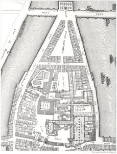
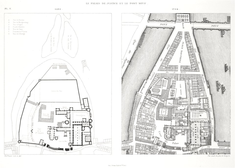
palais de la cité
conciergerie
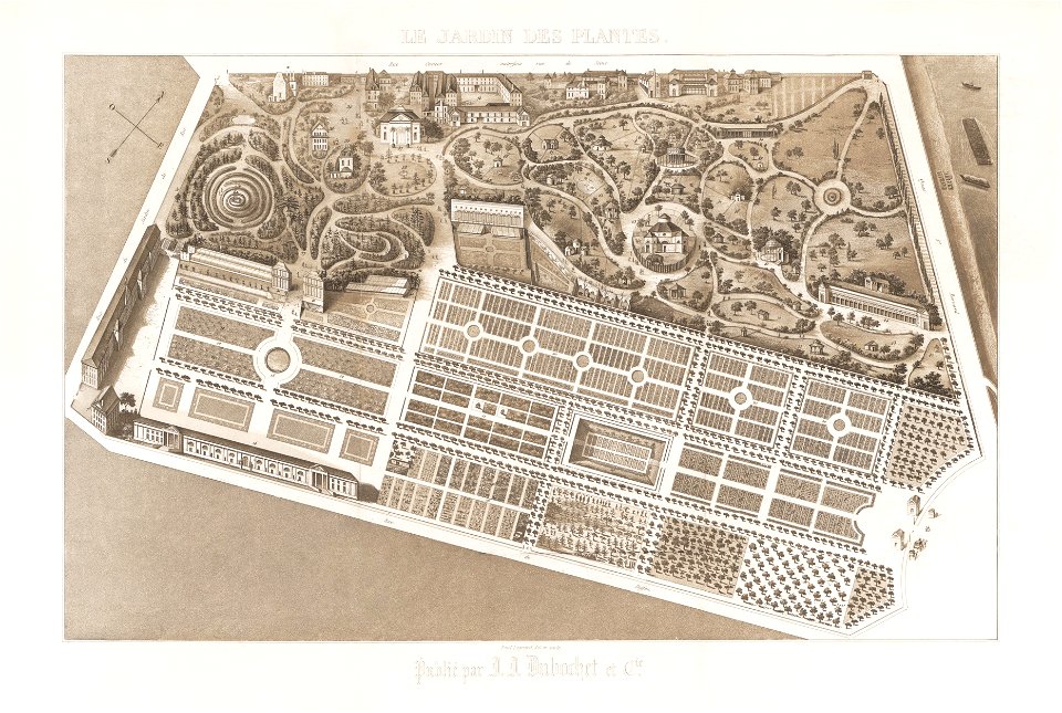
images from metropolitan museum of art (paris project)
1842 in paris
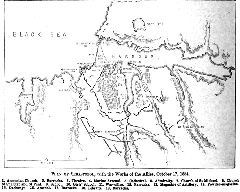
pictorial history of the russian war 1854-5-6 by george dodd
old maps of sevastopol
itinerario (jan huygen van linschoten)
old maps of goa
architectural prints by wenzel hollar
old st paul's cathedral
architectural prints by wenzel hollar
old st paul's cathedral
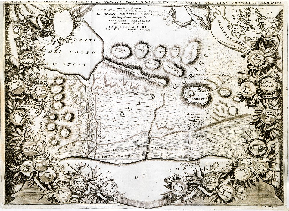
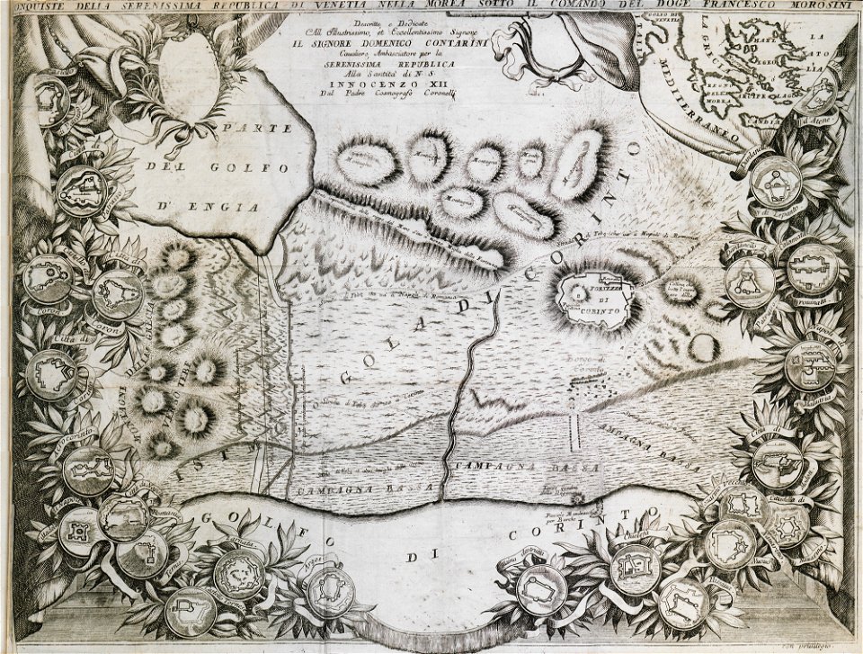
geographical illustrations by coronelli
old maps of the peloponnese
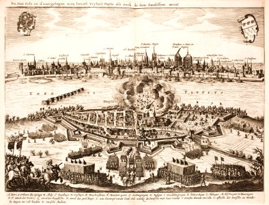
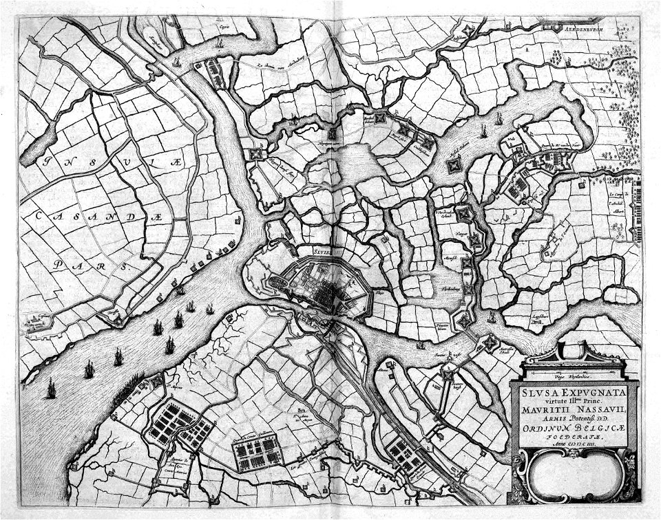
siege of sluis 1604
atlas beudeker
atlas de wit 1698
frederick de wit
prints from bonne atlas de toutes les parties at the peace palace library
dien (printer)
historical images of île de ré
siege of la rochelle
palais du louvre in the 1610s
palais du louvre on old maps
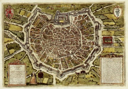
braun & hogenberg
milan
maps of louisiana
louisiana
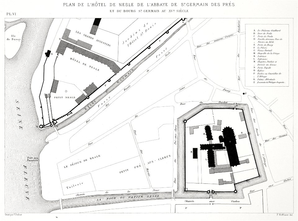
saint-germain-des-prés
lithographs of paris
zürich hauptbahnhof
1847
historical images of baden
switzerland
prints from bonne atlas de toutes les parties at the peace palace library
dien (printer)
geographical illustrations by coronelli
old maps of the peloponnese
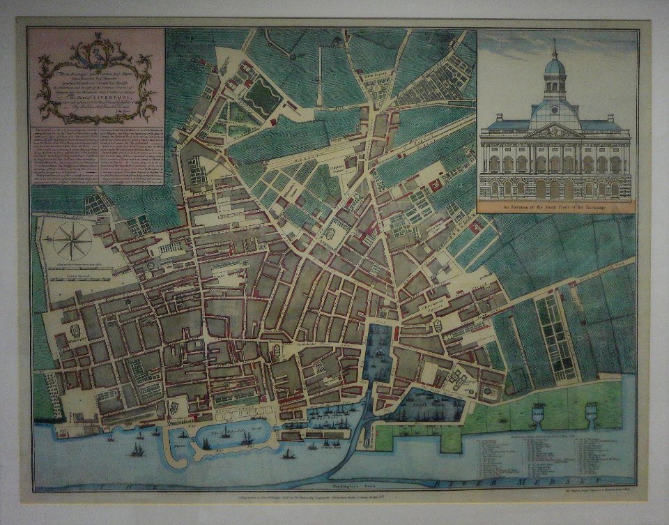
1765 works in the united kingdom
old maps of liverpool
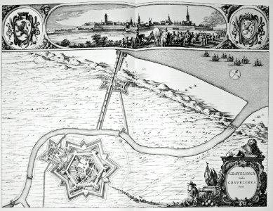
maps of gravelines city wall
old maps of gravelines
vintage
maps
streets
maps
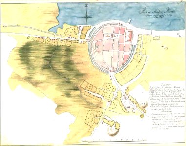
old maps of saint-benoît-sur-loire
1645 maps
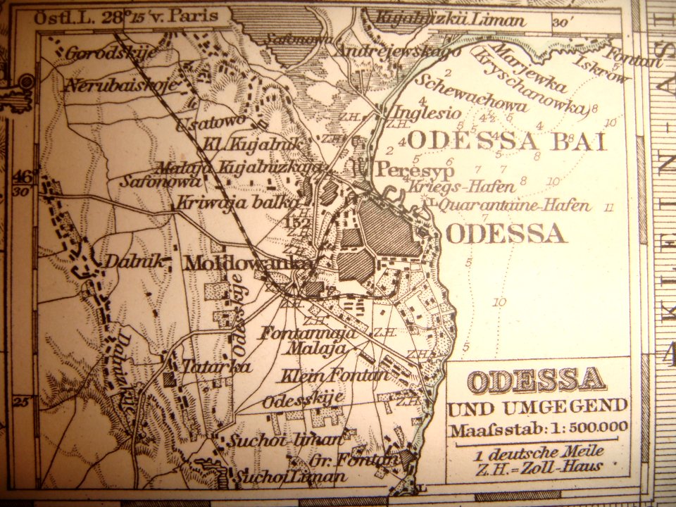
maps of the history of odessa oblast
old maps of odessa
old maps of pomerania
history of barth
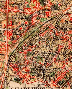
old maps of charleroi
broucheterre
old maps of bredevoort
landscape
old maps of charleroi
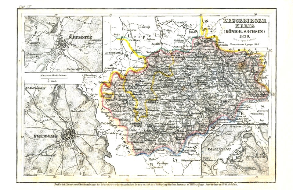
old maps of saxony
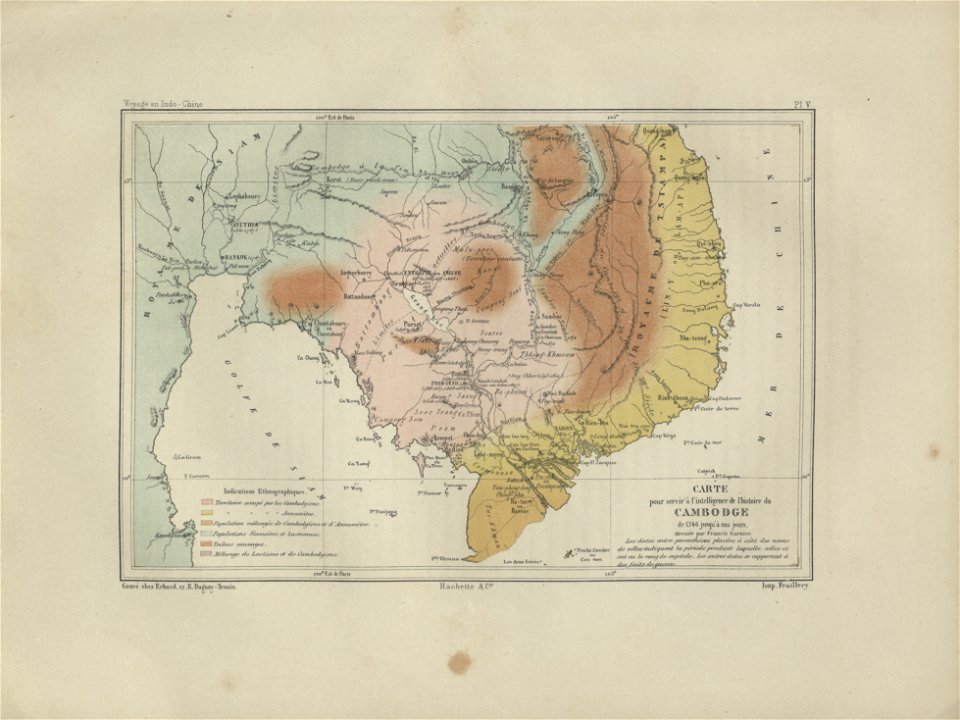
old maps of cambodia
francis garnier
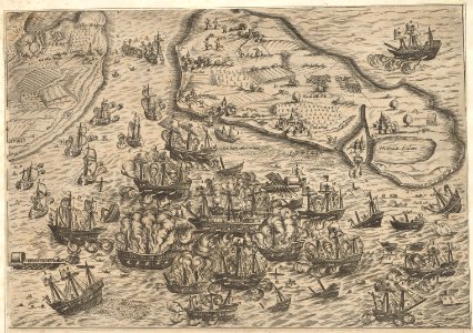
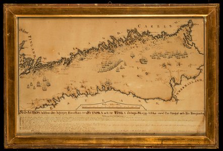
naval battles involving sweden
russo-swedish war (1788–1790)
lithographs of paris
floor plans of paris
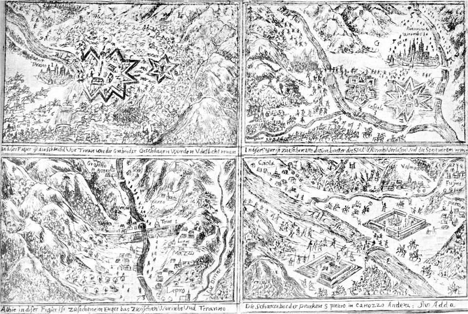
historical images of the canton of graubünden
valtellina
4501 - 4600 of 11,660
Next page
/ 117